DRAWinU_logo-01DRAWinU_logo-01logo-mobileDRAWinU_logo-01_mobile
    • Project
    • Team
    • Partners
    • Activities
    • Resources
    • Drawing Repository
    • Marginalia
      • Home
      • Drawing Repository
      • AREA
      • Parishes of Esposende in 2011
      Choropleth Map: Population Density in the Municipality of Esposende, by Parish (2011)
      January 11, 2023
      Plan at layer 4 level – level IV-II of the entrance area: Housing
      January 11, 2023
      Categories
      • AREA
      • CONTEXT
      • Faculdades da UP
      • FLUP
      • LOCATION
      • Paper
      • SUPPORT
      • Territory Research
      • VARIA
      Mapa de enquadramento - Freguesias do Concelho de Esposende, em 2011
      AUTHOR

      Juliana Borges Costa

      TITLE

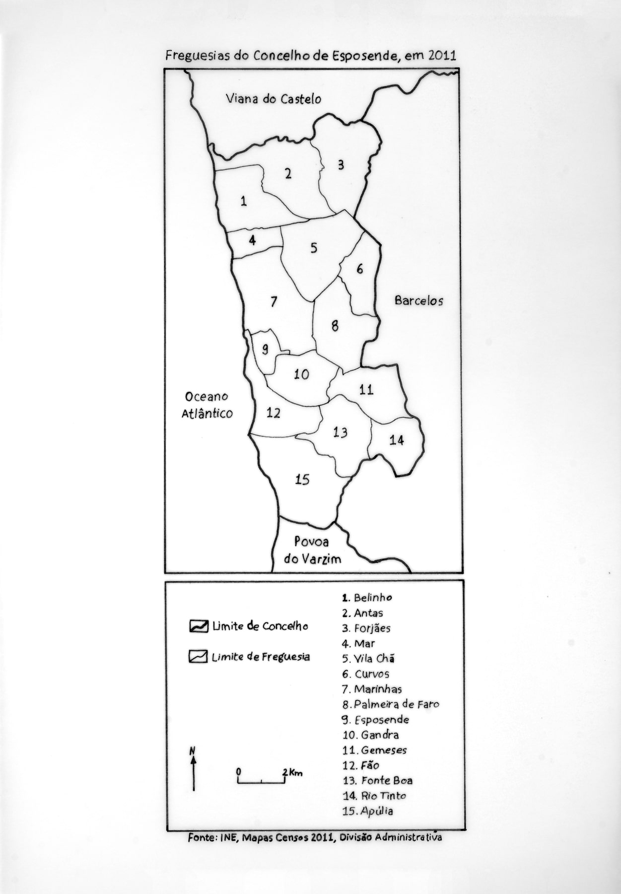
      Framing map – Parishes of Esposende in 2011 1:20000

      TECHNIQUE

      Ink on tracing paper

      DIMENSIONS

      29,8 cm x 21 cm

      DATE

      s.d.

      SELECTED BY

      Vasco Cardoso (i2ADS)

      COMMENTS

      Department of Geography (FLUP)

      AREA

      Territory Research

      LOCATION

      FLUP

      SUPPORT

      Paper

      CONTEXT


      VARIA


      Menu

      Project
      Team
      Partners
      Activities
      Resources
      Drawing Repository
      Marginalia

      Contacts

      Avenida Rodrigues de Freitas, 265
      4049-021 Porto

      +351 225192429
      i2ads@fba.up.pt

      Support

      © 2022, FBAUP. All rights reserved.